


CACHE Voting District, Alexander County, Illinois
About
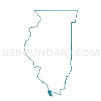
Outline

Summary
| Unique Area Identifier | 564530 |
| Name | CACHE Voting District |
| County | Alexander County |
| State | Illinois |
| Area (square miles) | 67.45 |
| Land Area (square miles) | 59.34 |
| Water Area (square miles) | 8.11 |
| % of Land Area | 87.98 |
| % of Water Area | 12.02 |
| Latitude of the Internal Point | 37.07369420 |
| Longtitude of the Internal Point | -89.27825410 |
Maps


Graphs
Select a template below for downloading or customizing gragh for CACHE Voting District, Alexander County, Illinois


Neighbors
Neighoring Voting District (by Name) Neighboring Voting District on the Map
- CAIRO 3 Voting District, Alexander County, IL
- CAIRO 5 Voting District, Alexander County, IL
- Charleston Rural Voting District, Mississippi County, MO
- Commerce Voting District, Scott County, MO
- Diehlstadt Voting District, Scott County, MO
- MOUND CITY 2 Voting District, Pulaski County, IL
- MOUNDS 1 Voting District, Pulaski County, IL
- MOUNDS 2 Voting District, Pulaski County, IL
- OLIVE BRANCH Voting District, Alexander County, IL
- SANDUSKY Voting District, Alexander County, IL
Top 10 Neighboring County Subdivision (by Population) Neighboring County Subdivision on the Map
- Tywappity township, Mississippi County, MO (6,514)
- Cairo precinct, Alexander County, IL (2,831)
- Barlow CCD, Ballard County, KY (1,494)
- Mounds precinct, Pulaski County, IL (1,319)
- Olive Branch precinct, Alexander County, IL (879)
- Mound City precinct, Pulaski County, IL (611)
- Sandusky precinct, Alexander County, IL (538)
- Commerce township, Scott County, MO (536)
- Cache precinct, Alexander County, IL (413)
- Tywappity township, Scott County, MO (393)
Top 10 Neighboring Place (by Population) Neighboring Place on the Map
Top 10 Neighboring Unified School District (by Population) Neighboring Unified School District on the Map
- Charleston R-I School District, MO (8,525)
- Ballard County School District, KY (8,249)
- Scott County R-IV School District, MO (5,905)
- Egyptian Community Unit School District 5, IL (3,878)
- Meridian Community Unit School District 101, IL (3,533)
- Cairo Community Unit School District 1, IL (3,218)
Top 10 Neighboring State Legislative District Lower Chamber (by Population) Neighboring State Legislative District Lower Chamber on the Map
- State House District 118, IL (99,068)
- State House District 1, KY (37,943)
- State House District 161, MO (34,576)
Top 10 Neighboring State Legislative District Upper Chamber (by Population) Neighboring State Legislative District Upper Chamber on the Map
- State Senate District 59, IL (209,843)
- State Senate District 27, MO (172,783)
- State Senate District 2, KY (105,262)
Top 10 Neighboring 111th Congressional District (by Population) Neighboring 111th Congressional District on the Map
- Congressional District 1, KY (686,989)
- Congressional District 12, IL (666,459)
- Congressional District 8, MO (656,894)
Top 10 Neighboring Census Tract (by Population) Neighboring Census Tract on the Map
- Census Tract 7804, Scott County, MO (5,335)
- Census Tract 7810, Scott County, MO (3,935)
- Census Tract 9501, Mississippi County, MO (3,887)
- Census Tract 9711, Pulaski County, IL (3,133)
- Census Tract 9710, Pulaski County, IL (3,028)
- Census Tract 9577, Alexander County, IL (2,172)
- Census Tract 9578, Alexander County, IL (1,528)
- Census Tract 9502, Ballard County, KY (1,494)
Top 10 Neighboring 5-Digit ZIP Code Tabulation Area (by Population) Neighboring 5-Digit ZIP Code Tabulation Area on the Map
- 63834, MO (7,135)
- 63736, MO (3,310)
- 62914, IL (3,147)
- 62988, IL (2,110)
- 62964, IL (1,456)
- 62969, IL (731)
- 62963, IL (611)
- 62962, IL (82)